RILEV@

Road accident technical survey kit
New module for the technical survey of road accidents. Specialized application on tablets for the management of planimetric surveys and acquisition of photographic documentation on the accident site.
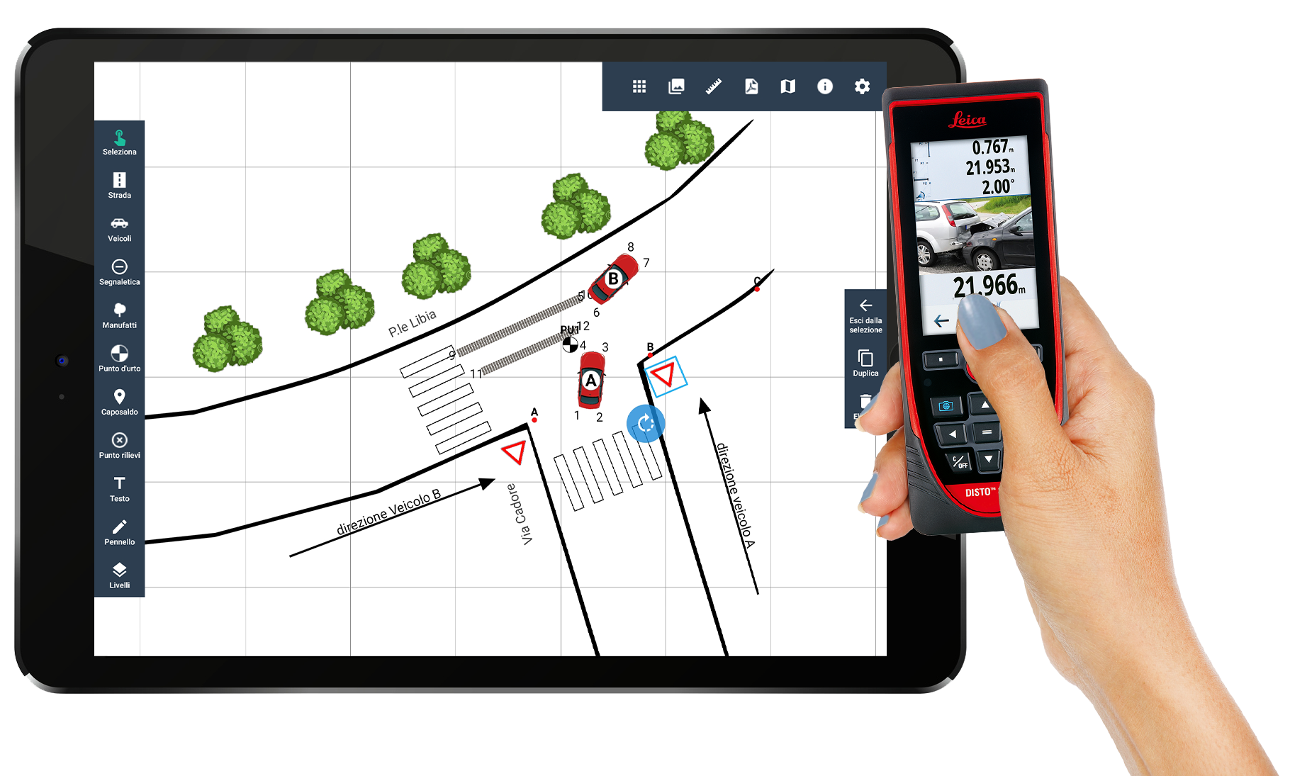
Rileva@ standardizes the drafting of the "planimetric survey report" at a high level, and the composition of the photographic file created directly at the accident site with a tablet.
The simple and intuitive interface of the procedure, in addition to simplifying and standardizing the surveys through the use of templates or integration with cartographic systems, significantly reduces intervention times and the possibility of making errors.
With specially designed graphic tools it makes it possible to quickly draw roads and reconstruct the accident site by dragging the necessary elements onto the screen, be they vehicles or artefacts.
Verbatel offers an "economical" and innovative solution, available on a mobile tablet, which allows you to quickly and easily draw all the objective elements detected in the area of the accident. The solution is integrated with Verbatel applications but can also be used with other applications or no management system.
Key strengths
Photographic file
The application supports the operator in drafting photographic documentation of the accident site who, upon arrival on site, can proceed to take photographic shots of the accident, the positions of the vehicles, etc.
The descriptions of the photos taken is suggested by the system which automatically detects what is necessary to produce a complete technical survey report. The system can be integrated with graphometric or remote signature processes that allow it to be signed digitally.
Geographic data collection
The collection of measurements takes place in a grid that the system automatically proposes, which allows either compiling by hand, following detection with traditional systems, or directly from reading from the certified measuring device connected to the tablet.
A printable PDF with drawing and measuraments is produced, which can be imported into management systems connected to it.
Integrated certified laser measurement systems
Today, technology allows the use of technological instruments that can replace or integrate old traditional measurement methods, especially at low costs and enabling more accurate results.
Rilev@ is natively integrated with the latest Disto Leica D5 and X6 electronic measurement systems.
The measurements can be collected with the usual and traditional tape measure wheel, or with Leica Geosystem's laser devices equipped with a camera pointer to locate the points even in bright light.

ROAD TRAFFIC SAFETY SOLUTIONS

GEO RISK ANALYSIS
Enables the top management of any police organization to compile report and plan ahead for a better deployment of resources and personnel.

GESTINC PAD
Web app bringing Gestinc capabilities on the road simplifying and expediting road accident management.

DOCUMENT RELEASE PORTAL
Road accident document release web portal for online request of copies of accidents.

STATISTICAL ANALYSYS
Data Analysis module. Prepackaging ready for external analysis by National Institutes of Statistics.

GESTINC WEB
Verbatel's flagship product with 30+ years of development is used to process more than 300k road accidents a year.


