GEO RISK ANALYSIS

Risk map and data analysis
VISIBILITY AND TRANSPARENCY FOR OVER 750 MUNICIPALITIES AND ON NATIONAL LEVEL
The use of our modules for the management of the various Command procedures will automatically feed two types of statistics:
- The activity of each individual Operator can be quantified by establishing the period of time to be analyzed, to analyze how many and which operations each individual Operator has handled with respect to the area of his/her competence.
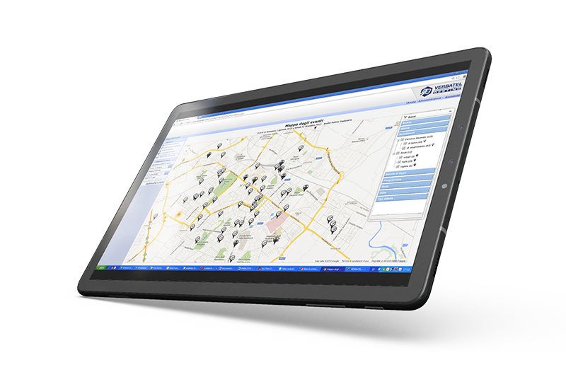
- Localization of each individual activity managed with the Verbatel modules in order to return a real Risk Map which highlights the critical issues (place and type of requests for intervention) and the activity carried out by the Police Force.
The two different types of statistics made available with this tool respond to the increasing demand of report requests of citizens and institutions regarding the activities carried out by Police Forces.
Key strengths
Territory Oversight
Thanks to the georeferencing of road accidents it is possible to analyze the phenomenon located in the area of competence with different analysis perspectives and with the participation of other sectors of the municipal administration it is possible to adopt specific road safety policies backed by data.
Statistical Analysis
With the data analysis module it is possible, thanks to different search and analysis keys, to produce reports on the phenomenon relating to road accidents with vision in relation to different points of views (locations, behavioral analyses, subjects involved, etc...)
Active
Monitoring and Intervention
Thanks to the real time, structured and quality data collection, the system is able to feed
data to Provincial, Regional and National Monitoring Centers or Forecast analysis systems
with application of artificial intelligence.
Thanks to georeferencing, the Police Force will be able, via Google Maps, to also make data available to other sectors of the Municipality/Ministry to allow identification of various types of critical issues (as per the map below which highlights the incidents which have involved so-called Weak Users, thus highlighting critical issues in the traffic environment for pedestrians, cyclists, motorcyclists).

ROAD TRAFFIC SAFETY SOLUTIONS

GESTINC WEB
Verbatel's flagship product with 30+ years of development is used to process more than 300k road accidents a year.

GESTINC PAD
Web app bringing Gestinc capabilities on the road simplifying and expediting road accident management.

DOCUMENT RELEASE PORTAL
Road accident document release web portal for online request of copies of accidents.

STATISTICAL ANALYSYS
Data Analysis module. Prepackaging ready for external analysis by National Institutes of Statistics.

RILEV@
Digitalized car accident sketch and photo report.


